Lesson 2. Layer a Raster Dataset Over a Hillshade Using R Baseplot to Create a Beautiful Basemap That Represents Topography
Learning Objectives
After completing this tutorial, you will be able to:
- Overlay 2 rasters in
Rto create a plot.
What You Need
You need R and RStudio to complete this tutorial. Also you should have an earth-analytics directory set up on your computer with a /data directory with it.
- Install devtools:
install.packages('devtools') Install ggmap from github:
devtools::install_github("dkahle/ggmap")- How to set up R / RStudio
- Set up your working directory
# load raster and rgdal libraries for spatial data
library(raster)
library(rgdal)
Overlay Rasters in R
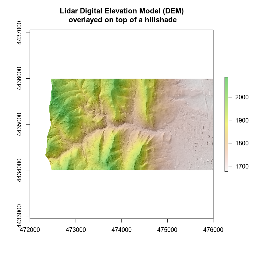
Here, you will cover overlaying rasters on top of a hillshade for nicer looking plots in R. To overlay a raster you will use the add = T argument in the R plot() function. You will use alpha to adjust the transparency of one of your rasters so the terrain hillshade gives the raster texture! Also you will turn off the legend for the hillshade plot as the legend you want to see is the DEM elevation values.
# open raster DTM data
lidar_dem <- raster(x = "data/week-03/BLDR_LeeHill/pre-flood/lidar/pre_DTM.tif")

# open dem hillshade
lidar_dem_hill <- raster(x = "data/week-03/BLDR_LeeHill/pre-flood/lidar/pre_DTM_hill.tif")

# plot raster data
plot(lidar_dem_hill,
     main = "Lidar Digital Elevation Model (DEM)\n overlayed on top of a hillshade",
     col = grey(1:100/100),
     legend = FALSE)

plot(lidar_dem,
     main = "Lidar Digital Elevation Model (DEM)",
     add = TRUE, alpha = .5)

Share on
Twitter Facebook Google+ LinkedIn
Leave a Comment